
Last week, I shared that my friend Kristine and I were embarking on a grand, 3 day, 30-mile adventure on the Ohlone Wilderness Trail between Livermore and Fremont, California. We had high hopes - and here’s what actually happened.
Day One
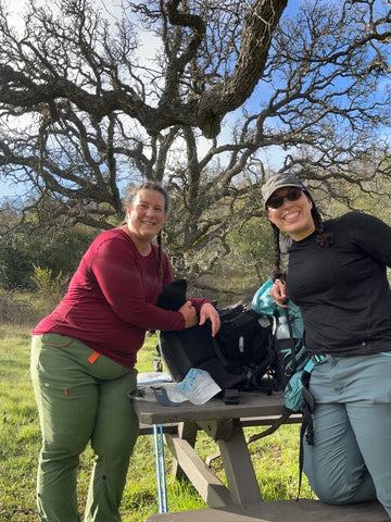
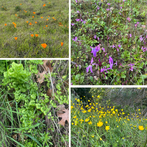
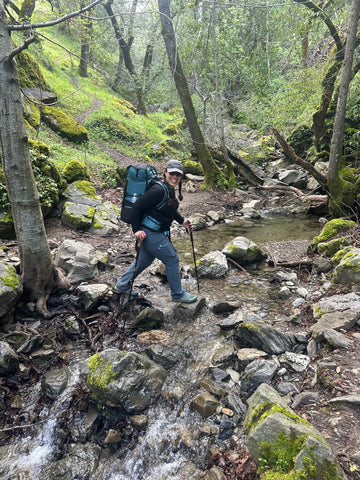
We started our day bright and early, stepping onto the trailhead at 7:20AM. Over the course of nearly 12 miles and 5900 feet of ascent, we saw incredible views of the Livermore Valley, beautiful wildflowers, and some really spooky scenes before the fog burned off.You know you’re doing a lot of uphill when lower uphill grades almost feel flat (and feel like a bit of a break)! We also took actual breaks, checking out the Murietta Waterfalls, and eating lunch and refilling our water bladders at a campsite along the path.
We made it to the top of Rose Peak, one of the highest peaks in the Bay Area at 3816 feet. We were pretty tired by the time we reached the peak, but the fog had totally burned off so we figured it would be worth it. And it was SO worth it!
We ended the day, sore and more than a little bit tired at our campsite not too far from Rose Peak - we set up camp, made dinner, and laughed with exhaustion. I was in bed by 7:30PM and had a pretty cold night, serenaded by cows, frogs, and even a couple of owls!
Day Two
We started our second day a bit stiff but not as sore as I would have expected, thanks to some egregious stretching the night before. We broke camp in amazing spirits and set off on the biggest day of hiking, expecting to clock in 13.8 miles and 4700 feet of descent.

We finally encountered the famous cows of the area, many of whom were adorable, playful calves! (Whatever you do, do NOT touch them or go near them!) The wildflowers were a little different on this side of the hill, and the terrain was quite open. Though the day started out sunny, it wasn’t too long before the clouds started to roll in and we noticed a significant change in the weather.
Before the trip, I watched the weather like a hawk (we saw loads of hawks as well!) - across multiple sources, there were mixed expectations about whether or not there would be rain on our second night. We decided to go as far as would make sense, and to at least find some rangers to get the latest weather information as close to our campsite as possible.
About three hours into our day, we bumped into a ranger on the trail, who informed us that it was looking like there might be some rain, and definitely a chill along with a potential for wind. As the day continued, the weather continued to get worse, and thanks to previous training days that resulted in very wet, very cold hikers (aka us!), we knew that the weather was not looking good.
We had lunch at another campsite on the trail and - after full bellies and our best chance of logical reasoning - made the call to leave the trail before things got too bad. Thanks to excellent planning ahead of time, we had an emergency escape plan in place, and used our satellite communicator to arrange a pickup. At our pickup point, we met a few more rangers, who said the weather forecast had changed, and that it was going to be a windy, cold, and wet night, and they reminded us that hypothermia is the second highest cause of death for the unprepared. (Note: we were absolutely prepared, and yet we also knew we were making the right decision!)
It’s funny how within ten minutes of getting picked up, it started to rain! Our campsite for the second night would have been exposed, making for a very-not-fun evening. And our third day was looking like it was going to be a steep, muddy mess - ripe for frustration and potential injury.
We absolutely made the right call. (We still ended up doing 10 miles and 4400 feet of descent!)

Playing it Smart
In motorcycling, it’s said that an expert rider is one who knows how to avoid getting into dangerous situations in the first place. I think the same is true for backpacking and any outdoor sport. Mother Nature always wins, so knowing how to read the signs and make smart decisions is how we can continue to have excellent days outside.
Could we have pushed and finished? Almost certainly. Would we have come out in one piece, excited to do another trip anytime soon? Maybe not so much.
By choosing to end our trip while we were feeling good, we walked away with joy in our hearts and excitement for the future. We’ve already started planning our next adventures (plural!), and I really couldn’t have asked for more.
Have you ever had to make a decision to cut a trip short even though you didn’t necessarily want to? What happened? Message us on Instagram or email us and let me know - I’d love to hear your story, too!
Blog posts

What does sustainability mean, anyway?
When things don’t always go as planned
